 Bardykes Mill, or more commonly known as The Black Mill, was situated on the River near the Priory Bridge. This would have been just as you exit Blantyre, on the left, at the edge of the river, on the approach to Caldergrove.
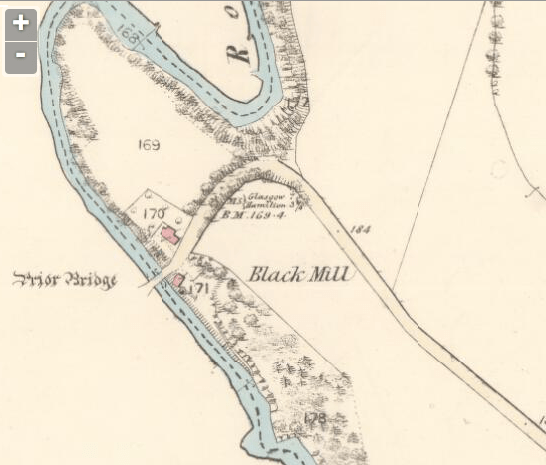
This map from 1859 shows the location. The long road leading up to it is Glasgow Road, now extended beyond and leading through to Cambuslang. The mill can be traced and dated back to at least 1748 belonging to the nearby Jackson family at Bardykes.
This mill was formerly a flour or corn mill, and in the 1850’s used for providing charred wood & coal dust , to make dross used for moulding purposes in Foundries. In some mills of this description coal dust was ground for putting in powder, & they were sometimes termed “Soot Mills” . This was also commonly termed a Soot mill. The mills at Cambuslang of the same description as this, were called “Black Mills” so the Miller considered the term to be appropriate for this one too. The mill was one of 6 major mills in Blantyre and as well as being also known as Bardykes Mill, it was later termed the Spittal Mill.
 Pictured here by James Brown is the current remains of The Black Mill on the east banks of the calder. It can be seen just behind the Priory Bridge at the West end of Blantyre and Glasgow Road, just beyond the houses at Callaghan Drive.
Further photos from Alex Rochead show the mill ruins in more detail.


