

A map from a lifetime ago. That is, if a lifetime is more than 80 years. Pictured is High Blantyre in 1935 and what a lot has changed. The picture is worth clicking on to magnify.
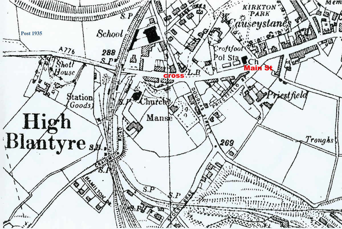
There’s no sign of the commercial buildings or even any cemetery exiting Blantyre towards Hillhouse, instead the remains of the coal fields. Of course road infrastructure was very different then too, with a noticeable lack of the EK expressway, the main road to EK being Stoneymeadow. In the town itself, the Hunthill Road school is there with the bike sheds at the back adjacent to the railway. At Causeystanes, just off Kirkton, it was very much more built up with tenements all along Main Street and Broompark Road.